Homage to Patagonia
There is some (pointless) debate in Patagonia regarding which is the more impressive massif - Torres del Paine or Mont Fitzroy. Having not had a chance to see the Torres up close (see last blog) we were never going to be in a position to judge, however we set off for Fitzroy with high expectations for to take in a peak that rises to a whopping 3441m above sea level.
Travelling to Fitzroy meant leaving Puerta Natales and Chile and heading for Calafate, just across the border in Argentina. From all accounts we´d love Argentina. People couldn´t help raving about the country, especially the steaks and all you could eat barbeques. It was painted as a place where the locals gorged on meat 24/7 with nary a vegetarian to be seen.
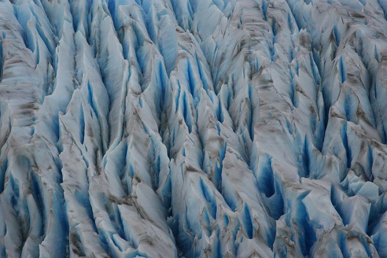
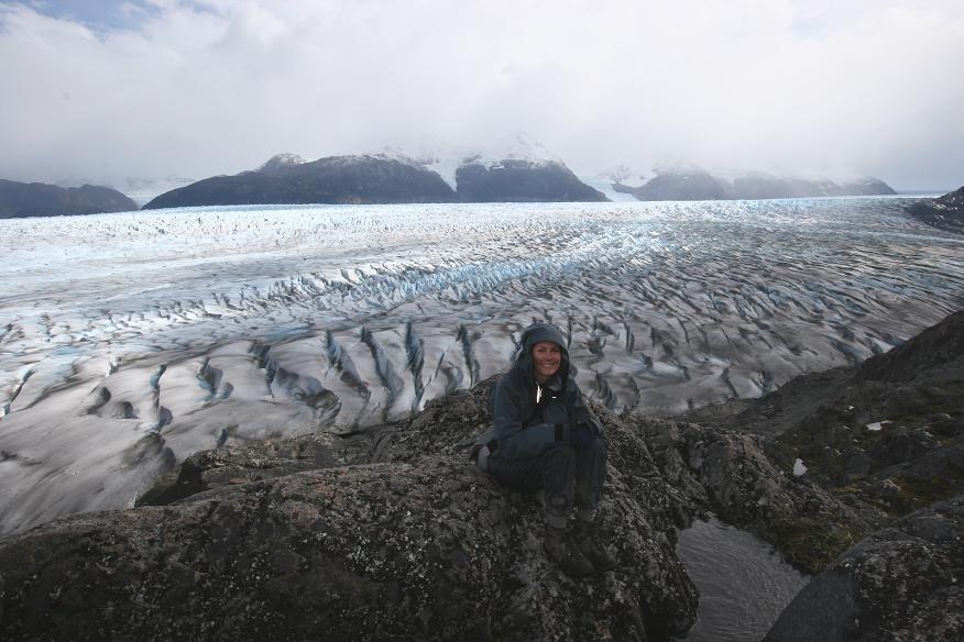
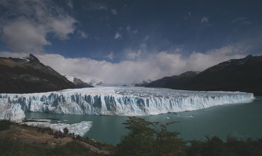
We found Calafate to be a town growing fat on the twin delights of Argentine beef and the gringo dollars of tourists lured to the town by the Moreno glacier : probably the most eaily accessible large glacier in the world.
We made the obligitary trip to the glacier and although we couldn´t deny that it was longer and taller than Glacier Grey the tourist hordes and the fact that you didn´t have to work for your view definitely detracted from the experience. Jane did get some amazing shots of the glacier being formed by large chunks of ice leaping out of the terminal lake and attaching to the face (see below).
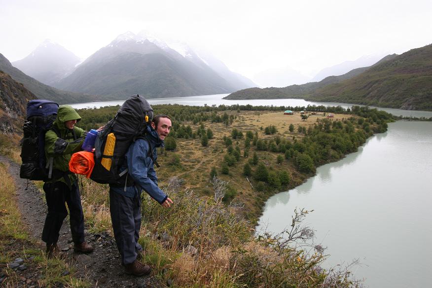
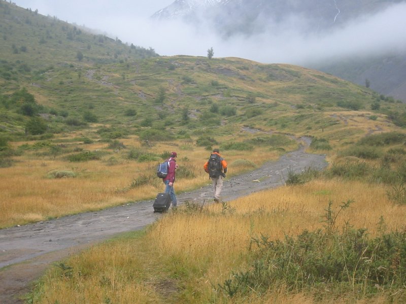
Our jump off town for the Fitzroy hike was El Chalten, a town at the end of a road to nowhere, whose sole purpose is servicing the tourists exploring the Park National Los Glaciers. The park that includes Mont Fitzroy. It was a four hour bus trip from Calafate which included obligtory stops for photos of Mont Fitzroy, Cerro Torre and the southern Andes.
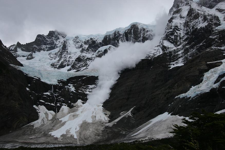
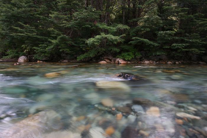
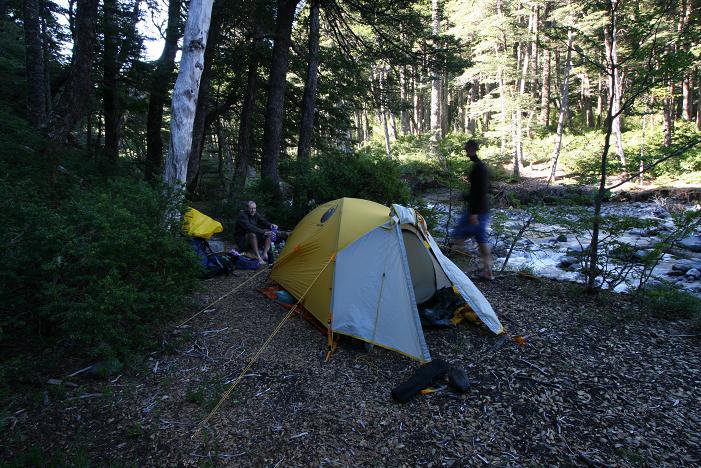
The weather was perfect so we hopped straight off the bus and into the wilderness, heading for Campamento Agostini nestled behind the terminal morraine of Glaciar Torre. Unfortunately, before we arrived, the weather had closed in so our views of Cerro Torre itself had largely disappeared. We had to satisfy ourselves with Glacier Torre itself, which is of the scale and mode of a New Zealand glacier - creeping down the valley rather than clinging to the walls.
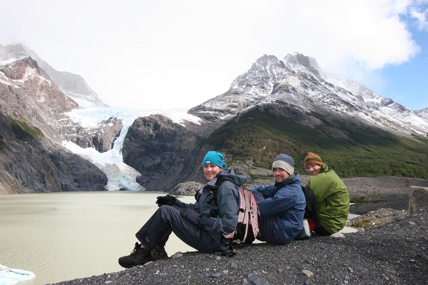
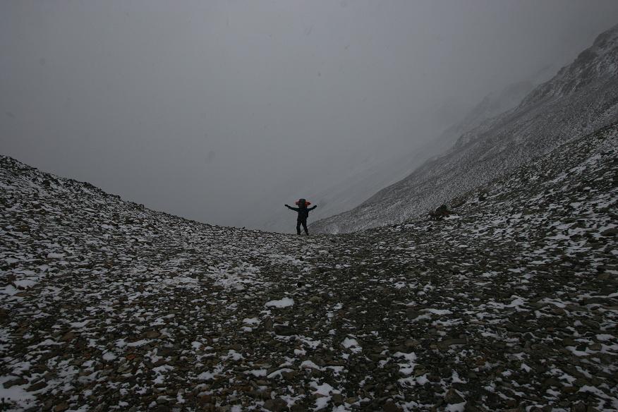
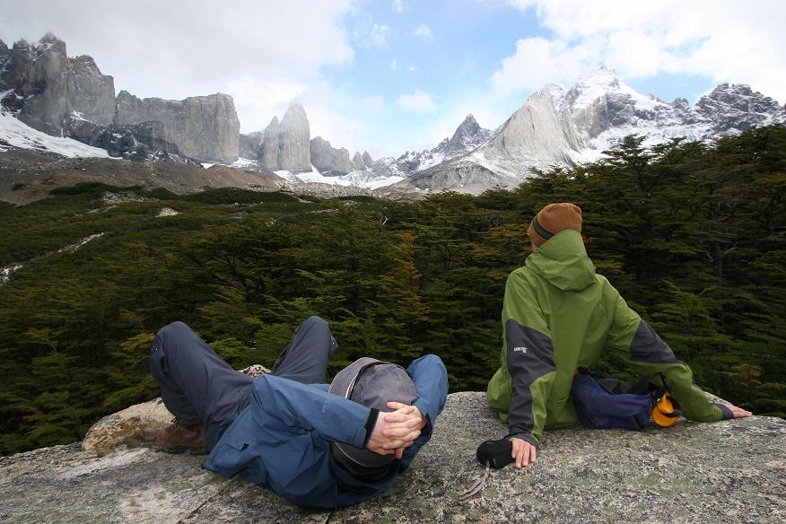
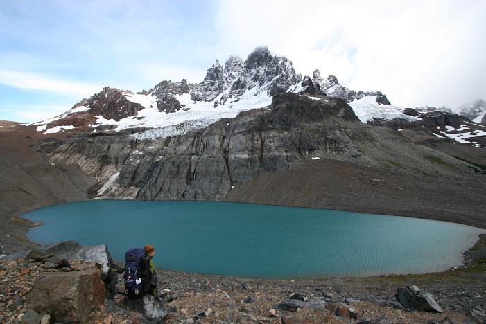
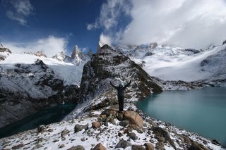
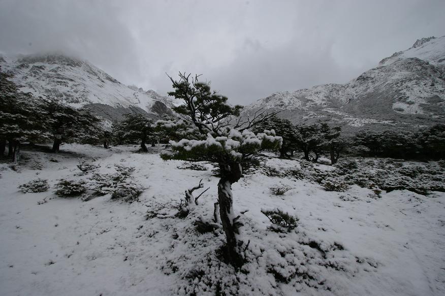
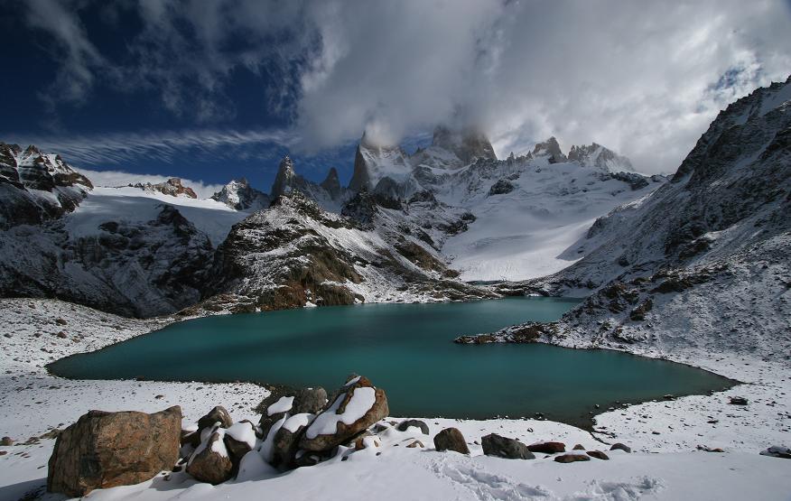
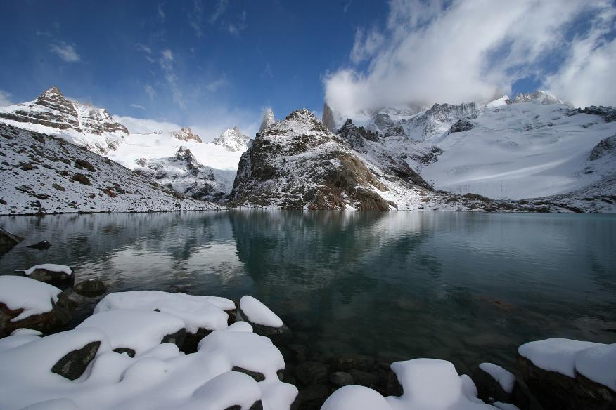
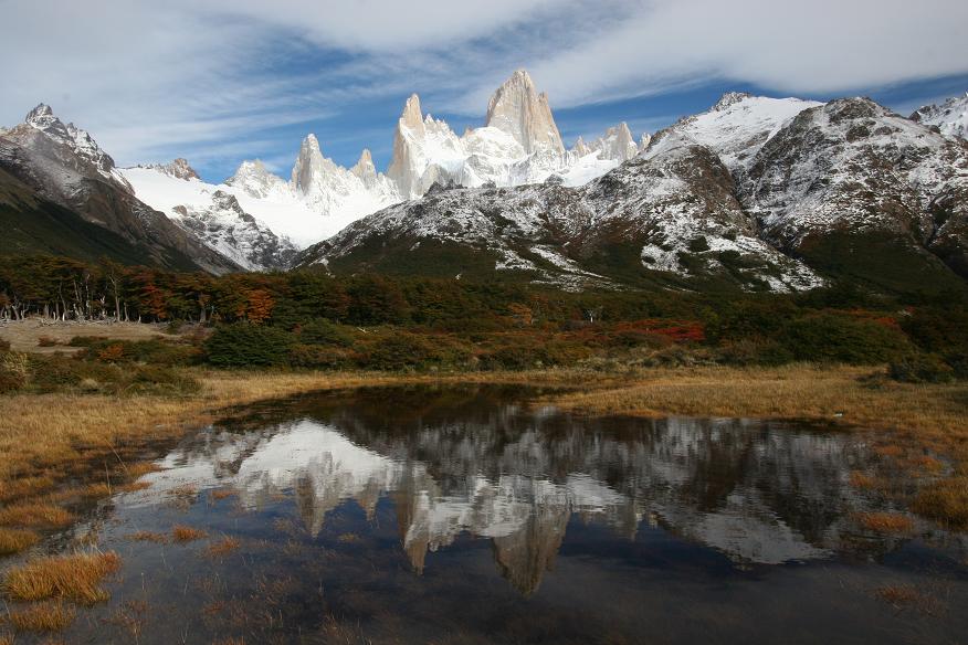
The next day we hiked to Campamento Poincenot along a very pleasant trail that took us above two typical patagonian lakes, picturesque and freezing. From Poincenot the view of Mont Fitzroy is awe inspiring to the point of drool. This is where the organised day hikes from El Chalten stop but we wanted to go one further and hiked up to the mirador situated at Laguna Los Tres (at about 1200 metres ) where unobstructed views of the peak can be enjoyed. Monte Fitzroy is the first order of granite massifs, the sheer sides soar up into the heavens destroying any conception of scale that you get from further back down the trail. It´s a peak that looks totally unclimbable and it´s a mystery to us where you´d start. In fact the views were so good we decided to spend a second day at the campsite, even though we had awoken that morning with snow on the tents - that´s a measure of how good it was.
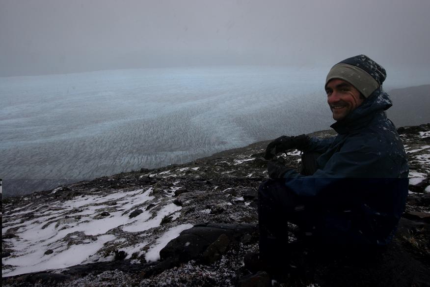
As the weather was still holding out on day four we backtracked to the Cerro Torre viewpoint that we´d passed on day one and were rewarded for our perserverance with a clear view of Cerro Torres, perhaps not as dramatic as Fitzroy and not quite as high but a sight well worth seeing. The peak thins and curves like the horn of a bull. As the sunlight waned it was back to El Chalten for showers and fondue (like any hardened mountaineer) and to prepare for the 6.30am bus back to civilisation the next day. Be warned - gratuitous mountain shots follow.
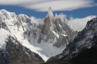
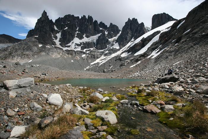
Cerro Torre

What we woke up to at camp on day 3
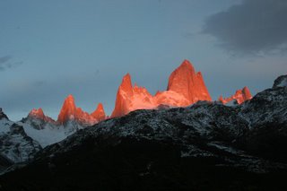
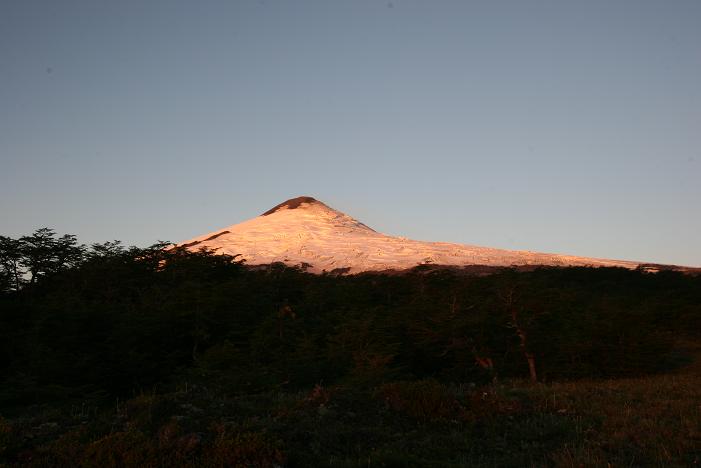
The sunrise postcard shot

Monte Fitzroy from Laguna Los Tres
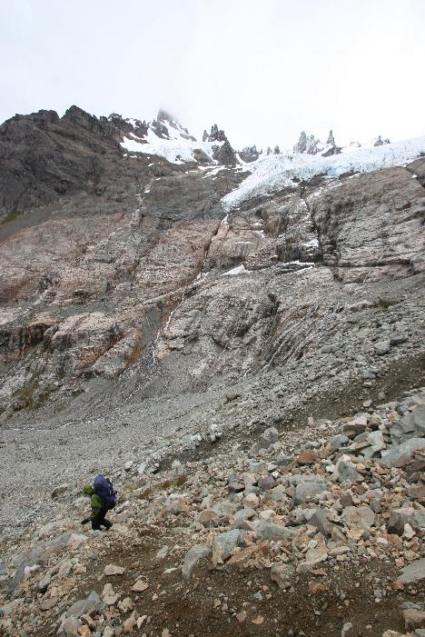
Jane on ridge between alpine lakes at Mirador Fiztroy

More Laguna Los Tres

Big ups to the Fitzroy Massif
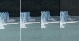
Glacier creation in action ... 30m chunk of ice mysteriously leaps out of water and attaches itself to the front of Glacier Moreno
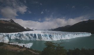
Glaciar Perito Morreno - go the wide angle.
Travelling to Fitzroy meant leaving Puerta Natales and Chile and heading for Calafate, just across the border in Argentina. From all accounts we´d love Argentina. People couldn´t help raving about the country, especially the steaks and all you could eat barbeques. It was painted as a place where the locals gorged on meat 24/7 with nary a vegetarian to be seen.
We found Calafate to be a town growing fat on the twin delights of Argentine beef and the gringo dollars of tourists lured to the town by the Moreno glacier : probably the most eaily accessible large glacier in the world.
We made the obligitary trip to the glacier and although we couldn´t deny that it was longer and taller than Glacier Grey the tourist hordes and the fact that you didn´t have to work for your view definitely detracted from the experience. Jane did get some amazing shots of the glacier being formed by large chunks of ice leaping out of the terminal lake and attaching to the face (see below).
Our jump off town for the Fitzroy hike was El Chalten, a town at the end of a road to nowhere, whose sole purpose is servicing the tourists exploring the Park National Los Glaciers. The park that includes Mont Fitzroy. It was a four hour bus trip from Calafate which included obligtory stops for photos of Mont Fitzroy, Cerro Torre and the southern Andes.
The weather was perfect so we hopped straight off the bus and into the wilderness, heading for Campamento Agostini nestled behind the terminal morraine of Glaciar Torre. Unfortunately, before we arrived, the weather had closed in so our views of Cerro Torre itself had largely disappeared. We had to satisfy ourselves with Glacier Torre itself, which is of the scale and mode of a New Zealand glacier - creeping down the valley rather than clinging to the walls.
The next day we hiked to Campamento Poincenot along a very pleasant trail that took us above two typical patagonian lakes, picturesque and freezing. From Poincenot the view of Mont Fitzroy is awe inspiring to the point of drool. This is where the organised day hikes from El Chalten stop but we wanted to go one further and hiked up to the mirador situated at Laguna Los Tres (at about 1200 metres ) where unobstructed views of the peak can be enjoyed. Monte Fitzroy is the first order of granite massifs, the sheer sides soar up into the heavens destroying any conception of scale that you get from further back down the trail. It´s a peak that looks totally unclimbable and it´s a mystery to us where you´d start. In fact the views were so good we decided to spend a second day at the campsite, even though we had awoken that morning with snow on the tents - that´s a measure of how good it was.
As the weather was still holding out on day four we backtracked to the Cerro Torre viewpoint that we´d passed on day one and were rewarded for our perserverance with a clear view of Cerro Torres, perhaps not as dramatic as Fitzroy and not quite as high but a sight well worth seeing. The peak thins and curves like the horn of a bull. As the sunlight waned it was back to El Chalten for showers and fondue (like any hardened mountaineer) and to prepare for the 6.30am bus back to civilisation the next day. Be warned - gratuitous mountain shots follow.
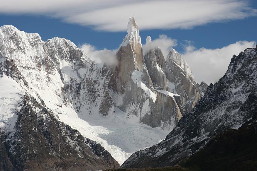
Cerro Torre
What we woke up to at camp on day 3

The sunrise postcard shot
Monte Fitzroy from Laguna Los Tres

Jane on ridge between alpine lakes at Mirador Fiztroy
More Laguna Los Tres
Big ups to the Fitzroy Massif
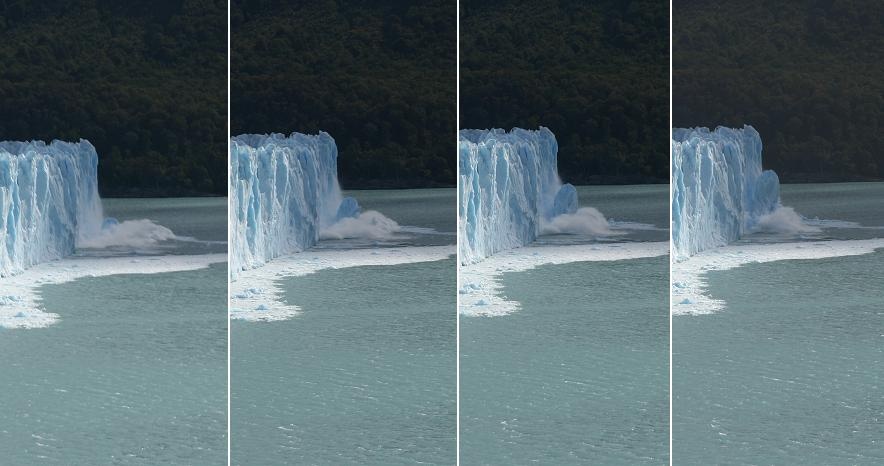
Glacier creation in action ... 30m chunk of ice mysteriously leaps out of water and attaches itself to the front of Glacier Moreno
Glaciar Perito Morreno - go the wide angle.
posted by Jane, Brett & Nick at
12:54 pm
|
3 comments
![]()